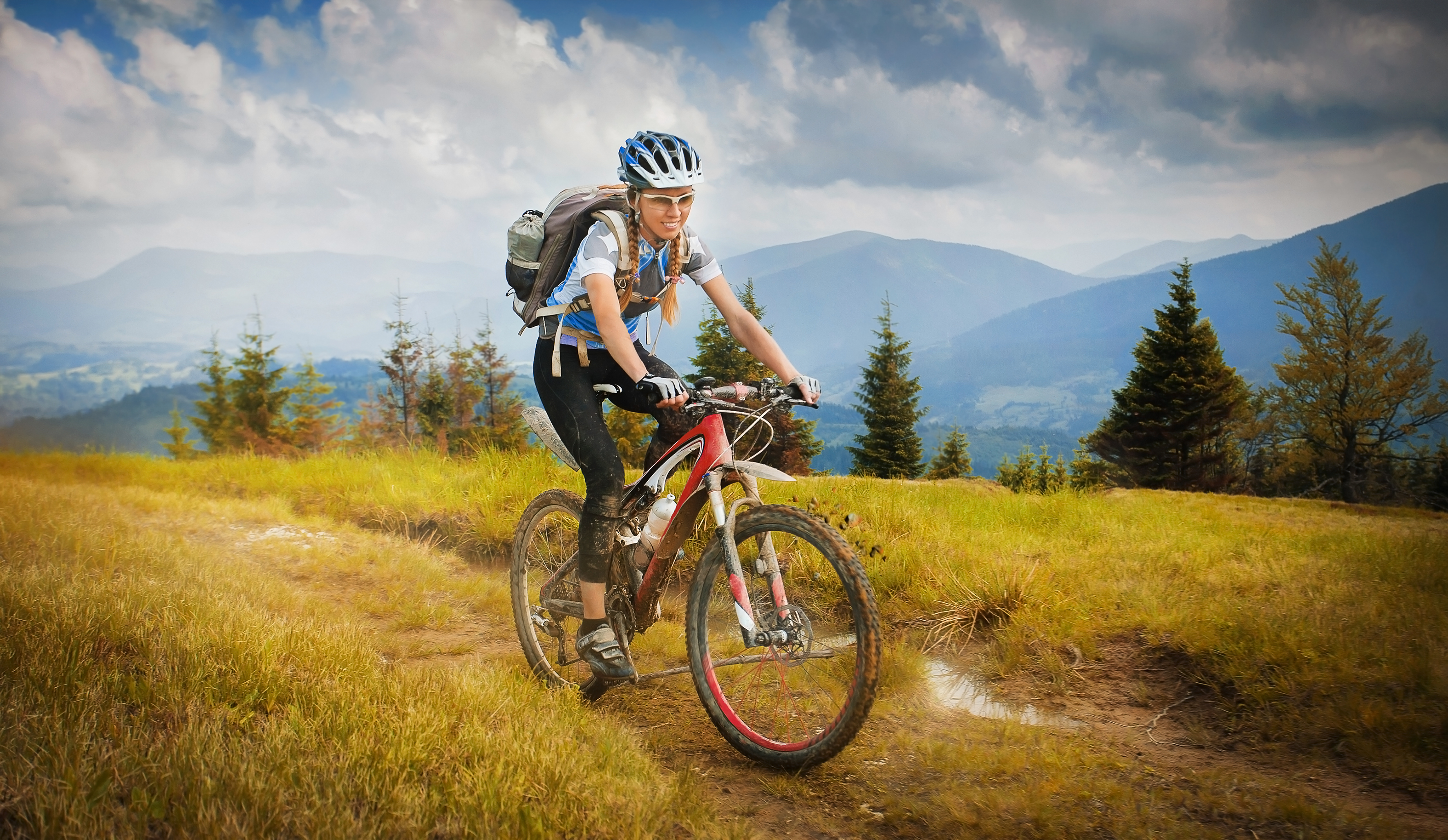
MOUNTAIN BIKING IN PAGOSA SPRINGS
With a wide variety of routes and terrain, Pagosa Springs is a virtually undiscovered mountain biking destination for riders of all skill levels. Lots of good stuff here…
Many area rides begin above 7,000 feet. Factor in time to acclimate before setting out on longer and more demanding rides.
- Ride on open trails only. Avoid trails when muddy and wet to prevent further damage.
- Leave no trace. Pick up trash.
- Control your bicycle. Uphill traffic has the right away.
- Always yield to hikers.
- Never spook animals.
- Plan ahead: Consider elevation, weather, location, length and difficulty of ride 7. Enjoy the ride
IN TOWN TRAILS
Reservoir Hill Mountain Park
Difficulty: Beginner to Advanced Mileage: 1.4 to 4 miles
Route: Out and back, or loop
Trails: Dirt, single and double track Elevation range: 7,280 to 8,000 feet
Description: It is extremely lucky to have this little loop in the center of town. Though quite challenging and secluded, the trail is easily accessible, and can be connected to the Dakota Springs High School Trail with a short ride on the San Juan River Trail or Hot Springs Blvd. Future phases of the DUST2 Urban Single Track Trail Initiative will continue to enhance the Reservoir Hill trail system.
Getting There: Two trailheads access Reservoir Hill: Spa (above the Healing Waters Resort and Spa on Hot Springs Boulevard) and San Juan (behind the San Juan Motel, on U.S. 160). Both trailheads have maps.
Dakota Springs High School Trail
Difficulty: Beginner to Advanced
Mileage: 2 miles loop, Can be connected with Riverwalk Path and Reservoir Hill Route: Out and back, or loop
Trails: Dirt, single track
Elevation range: 7,280 to 8,000 feet
Getting There: The best starting point for this urban single track is the connector trail off South 5th Street in Yamaguchi Park. Take the connector trail next to the baseball field and then follow this amazing multi- loop trail counterclockwise as it winds behind the high school with two interconnecting trails.
You can now easily connect your Dakota Springs ride with the Reservoir Hill trail system by taking Hot Springs Blvd, or the San Juan River Trail to the Reservoir Hill Trail Head.
DUST2 Connector Route
Difficulty: Beginner Mileage: 0.4
Route: Connector trail
Trail: Dirt, Single Track Elevation: 7,000’
Description: This single track connector trail connects Dakota Springs High School Trail to Yamaguchi Park.
Cloman Park:
Difficulty: Beginner Mileage: 2.2
Route: Loop
Trails: Dirt, Single track Elevation: 7300’
Cloman Park is an Archuleta County park with one 2.2 mile, multi-use, single track figure-8 winding through ponderosa pines. The lower part of the single track loop is good for beginner riders while the upper section is intermediate.
Getting there: Drive 1.3 miles north on Piedra Road from Highway 160. Turn right (east – entrance to Steven’s Field airport) on Cloman Blvd for 1.4 miles. Stay left at the fork in the road which then dead ends at the large parking lot.
Turkey Springs Trail Network:
Difficulty: Beginner to Intermediate Mileage: 30+
Route: Out and Back or Loop
Trail: Dirt, Single Track, Double Track Elevation: 7,000-7,500
Description: This is a great cross-country style trail system with 30+ miles of intertwining beginner and intermediate multi-use trails nestled within a ponderosa pine forest. While well marked, it is easy to become turned around or end up the ATV trails. So, stop at each intersection and consult a map.
Getting There: The Turkey Springs trailhead is 5.3 miles north on Piedra Road from the intersection of Piedra Road and 160 highway. The trailhead parking lot is on the left, immediately after the cattle guard.
MOUNTAIN TRAILS
Continental Divide Trail
Difficulty: Intermediate to Advanced Mileage: 15+
Route: Out and Back or loop
Trail: Dirt, Single Track
Description: The CDT is truly an “epic” Colorado trail. One of the areas most beautiful mountain biking venues, the CDT trail has it all. From rocks to trees to flowers. Folks, it doesn’t get ANY better than this.
Getting There: From the large parking area at the summit of Wolf Creek Pass, pedal through the meadow on an obvious trail and cross a creek on a wooden bridge. Turn left after crossing the bridge—there’s a social trail here that heads right and will lead you off track.
From here, the trail climbs steadily through old-growth forest that’s been heavily affected by pine beetles or some other tree-killing vermin—a large percentage of the pines here are gray and dead. There are a few tight, steep switchbacks but almost everything is easily rideable by an intermediate to advanced rider.
Shortly after navigating some switchbacks in a scree field, the trail will contour around to a south aspect and you’ll come to a “junction” with Treasure Mountain Trail #565. “Junction” gets quotes here because there are a USFS sign and a rock cairn, but the trail itself is basically non-existent.
Past this junction, the trail gains the ridge just west of and below Alberta Peak, at the top of Wolf Creek Ski Resort.
Do-right Trail
Difficulty: Advanced
Mileage: 4 miles of single track using a shuttle 12 miles riding the loop
Route: Shuttle or loop one way
Trail: Dirt, single track, gravel roads
Note: Motorcycles are permitted from June 15 to August 31 on the single track
This is described as a loop ride, but the gravel road sections can be replaced by shuttling with 2 vehicles. You will climb from 7500 feet to 9100 feet and then descend back down to 7500. Don’t go alone. Advanced riders should find the entire loop rideable.
Getting There:
Drive west from Pagosa Springs on Hwy 160 towards Durango for about 22 miles. Turn right onto First Fork Rd (USFS Rd 622), this is on the east side of the Piedra River. Take First Fork Rd north for approximately 7 miles to the Sheep Creek Trailhead. Park at this trailhead.
The Ride: From the trailhead do not ride the Sheep Creek trail. Head east on Monument Road (USFS Rd 630) directly across from the trailhead for approximately 7 miles. This is a 1600 foot elevation climb on a gravel road through Aspen trees with big vistas of the Piedra valley. Once you get to the turnaround at the end of Monument Rd take an immediate left to the west through the steel single track barrier. You are now on the Do-right trail. This is a 4 mile, 1500 foot flowy descent back to First Fork Rd. Once you reach the end of the single track you are at First Fork Rd. Take a left and head south for approximately 1 mile back to the Sheep Creek trailhead.
Snow Springs Trail
Difficulty: Intermediate/Advanced
Mileage: 16
Route: Out and Back
Trail: Dirt, single track, double track,
Note: that this is trail 605 on the Pagosa MVUM (Motor Vehicle Use Map)– motorcycles are permitted.
This is described as a one-way ride with a shuttle because it is a beautiful descent with enough climbing. You will climb over 2000 feet over this 15.6 mile route, but you’ll descend over 4,400 feet. Your high point is above 9800 feet elevation; your finish is around 6800 feet. Because this is also a horse trail and is fairly isolated/remote (don’t expect to bump into anyone else out there), only expert riders should tackle this route. Don’t go alone. Advanced riders, however, should find almost everything rideable.
Getting There: This ride is described here as a shuttle ride, so you’ll need two vehicles for these directions.
Drive east from Pagosa Springs on Hwy 160 towards Durango for about 11.6 miles. Turn right onto Badger Rd (USFS Rd 628) and ask permission to park at the Turkey Springs Trading Post. Leave one vehicle. With the other vehicle, continue towards Durango another 10.5 miles (total of 22 miles). Turn right on First Fork Road (just before crossing the Piedra River). Drive up First Fork Road (USFS Rd 622) 6.8 miles. Turn right
onto West Monument Rd (USFS Rd 630W) and drive another 6.5 miles to the end of the road. Unload. This is the trailhead.
The Ride: Go around the gate off the end of the road and follow the ATV trail.
At mile 1.78 turn right onto the single-track Devil Mountain Trail (USFS Trail 600).
At mile 2.6 you’ll see another singletrack going to your right. Ignore this and continue straight.
The trail will soon stop climbing and will break out into open meadows on the top of a ridge with huge views on both sides. Continue along the ridge for a couple miles until you come to another fork in the trail. Turn left (USFS Trail 603). This trail starts a rather abrupt descent down the north side of the ridge.
Continue following the trail in a southwesterly direction following signs for “Snow Springs Trail” (USFS Trail 605).
At mile 8.4 you intersect another ATV trail. Go directly across this doubletrack looking for a continuation of the single track route.
At mile 10.5 you break out onto a gravel road. Follow this road.
At mile 14 you intersect USFS Rd 628. Turn right.
At mile 15.6 you arrive at the Turkey Springs Trading Post and your vehicle.
Treasure
Difficulty: Advanced
Mileage: 8+
Route: Shuttle, Out and Back Trail: Dirt, Single Track
A remote and solitary high country trail in the South San Juan Mountains off Wolf Creek Pass with a big descent. Truly a Colorado Classic not to be missed. From the lower trailhead, the trail climbs on moderate grades through scenic aspens and firs. Eventually, the trail intersects Windy Pass Trail.
Getting There: This ride is best done as a shuttle.
Many street cars will be able to reach the lower trailhead off E. Fork Road. There are some rocky arroyo crossings beyond about 37.402, -106.82 that will stop low clearance cars and RVs. Look for parking or camping spots and ride on up the road to the trailhead.
If you plan to do this trail as a shuttle, from the top of Wolf Creek Pass, heed the warning above. You’ll ride the CDT to the top of the ski area and look for a rock cairn and a USFS sign posted on a tree. These will be your only clues that there’s a trail here because there’s literally not signs of an actual path. Make your way down the grassy gully and head right when you reach the flat meadow below. Use of the MTB Project mobile app will be crucial to keeping you on track here. Head left into the trees and down the second pitch. The trail becomes much more apparent here, but it’s still faint by most standards.
When you reach Wolf Creek Road USFS #725, head left for about a mile with a little climb to the epic single track downhill section of the trail. Drop down the steep sidehill through the burn area.
After some great views and narrow sidehill, you’ll come to another steep moonscape section. After a few creek crossings and sections of true downhill riding, you’ll arrive to a big, open meadow that is the Windy Pass Trail intersection. The rest of the trail has more flow and speed as it sweeps through aspen groves and meadows. Once you arrive at a cattle gate, the ride shreds down a sidehill through oakbrush and open slopes until you reach the bottom.
The ride can be done as an out-and-back from the East Fork with many hike-a-bike sections after the Windy Pass Trail intersection.
It’s better done as a shuttle from the CDT at the top of Wolf Creek Pass or riding up Wolf Creek Road USFS #725 to avoid the top steep section. Most people leave a car at the large parking area at the start of the East Fork Road #667.
For more information on routes, directions and maps, check out the websites below:
- https://www.fs.usda.gov/recmain/sanjuan/recreation
- https://www.mtbproject.com
- www.pagosatrails.org
- www.singletracks.com
- www.dustx2.org