Trail Update – 10/23/25 Due to recent flooding West Fork Trail is washout in sections including Bridges and the trail impassable. Please stay off trail until damaged can be repaired as river levels are still higher than normal.
Please share any trail updates in the Comment section below


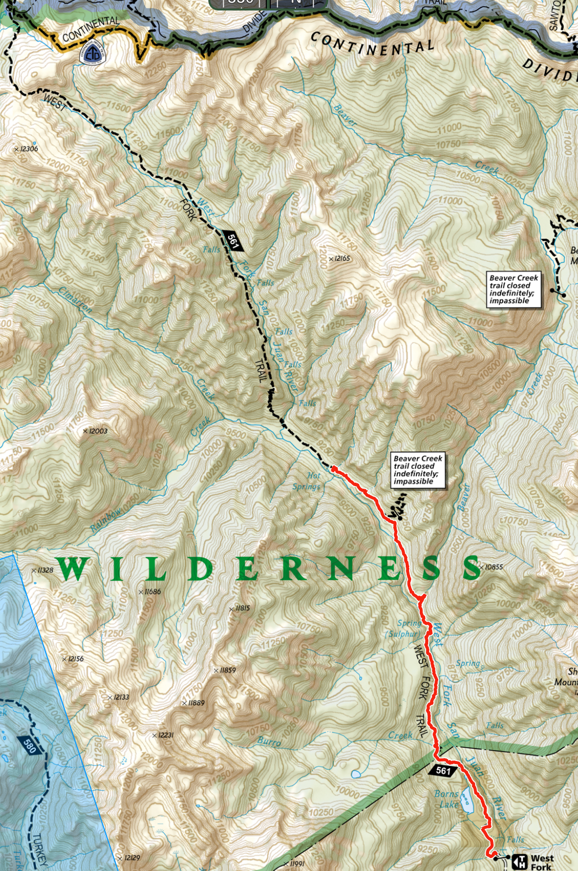
West Fork Trail #561 Map <click here>
Length: Total trail: 11.6 miles to Continental Divide one-way. Suggested hikes: 3 miles to bridge crossing, one way, then return to trailhead; 5 miles to hot springs, one-way, then return to trailhead.
Elevation Stats: Elevation gain of total trail: 3,100 ft (altitude 8300 ft. – to 11,400 ft); suggested day hike to hot springs 1,044 ft (altitude 8300 ft. – to 9344 ft)
Trailhead facilities: small parking lot at trailhead
The first mile of trail is through private property, so stay on the trail. At about 3 miles, there is a nice bridge crossing of the West Fork and a level area for lunch. At approximately 5 miles, there are a number of very steep trails to the left leading down to the creek and hot springs. EXERCISE EXTREME CAUTION ON THESE STEEP SIDE TRAILS. Camping is permitted only in existing sites at least 100 feet from water. At mile 6, the trail begins to climb steeply. There are several stream crossings before reaching the Continental Divide Trail at Piedra Pass.
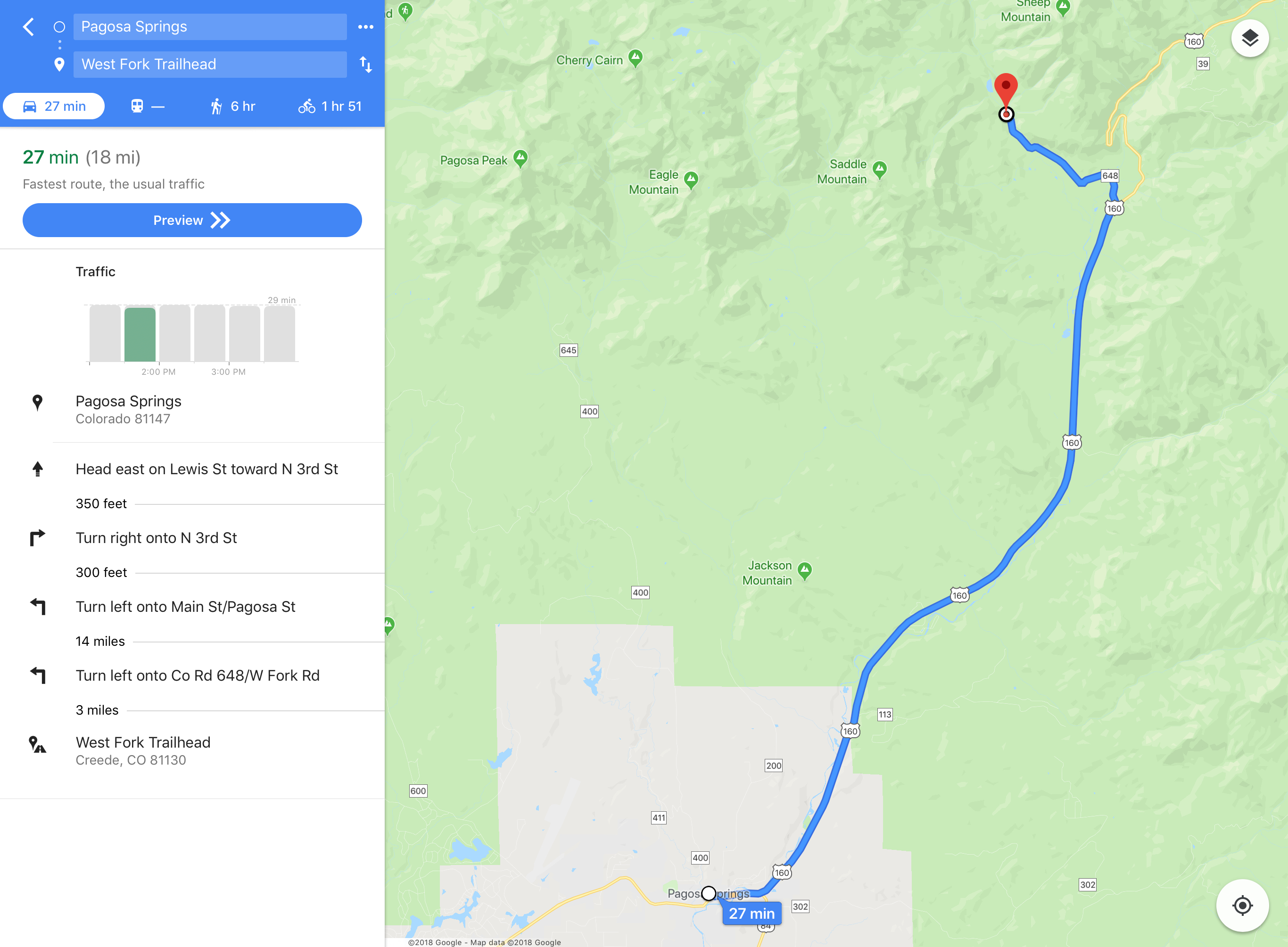
Driving directions: Travel east on US 160 from Pagosa Springs for 15 miles. Turn left on West Fork Road (NFS 648). Left at intersection before campground, continue until road ends at trailhead and parking lot.
Driving directions Map:<click here>
We hiked last week. 5 miles out & back but couldn’t find the hot springs. Later a hiker told us they are opposite the camping area and we didn’t go that far. We went in river which was great bc we were boiling hot. The trail is so exposed – all sun. I knew that and I didn’t even bring my dog bc he would be so hot on it. It’s a challenging hike with lots of rock. On return, it rained for last 3.5 miles. Nice change from the sun. Even with that I drained 3 liters of water by mile 8.5. Views are wonderful (though trees are mostly missing)
6/17/2024: There is a down tree across the trail .2 miles in from the Wilderness Boundary. Also, the trail up from the waterfall creek is sliding into the river. Be aware of loose sand and gravel.
6/25/2022 Trail had several trees across trail that would stop horses before the hot Springs
The Rainbow trail is blocked for equestrian traffic about 2 miles in with a large Pine Tree across the trail – and no safe way around as of 7/18/2021