Trail Update: 06/07 /25 Trail Cleared and cleaned up by San Juan Back Country Horseman, DUST 2, and San Juan Outdoor Club.
Please share any trail updates in the Comment section below


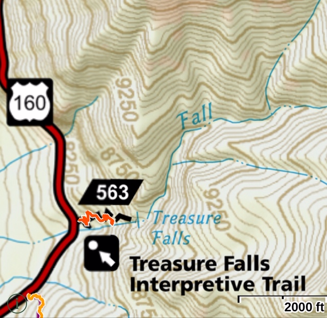
Treasure Falls #563,685,670 Map: <click here>
Length: 0.3 mile – one way
Elevation Stats: starting elevation 8500 feet. Elevation gain 325 feet.
Trail Summary: Short, accessible interpretive trail located on Highway 160 is a very popular stop along Highway 160. Trail begins on left side of parking lot. After a short uphill walk, a spur trail to the left leads to Valley View overlook; go right to continue to falls. Follow the trail through the forest to a second spur leads to Misty Deck at the base of the falls or go right to cross a footbridge with a great view of the 100’ waterfall. On return to the parking lot, please heed signs not to shortcut between loops of the trail.
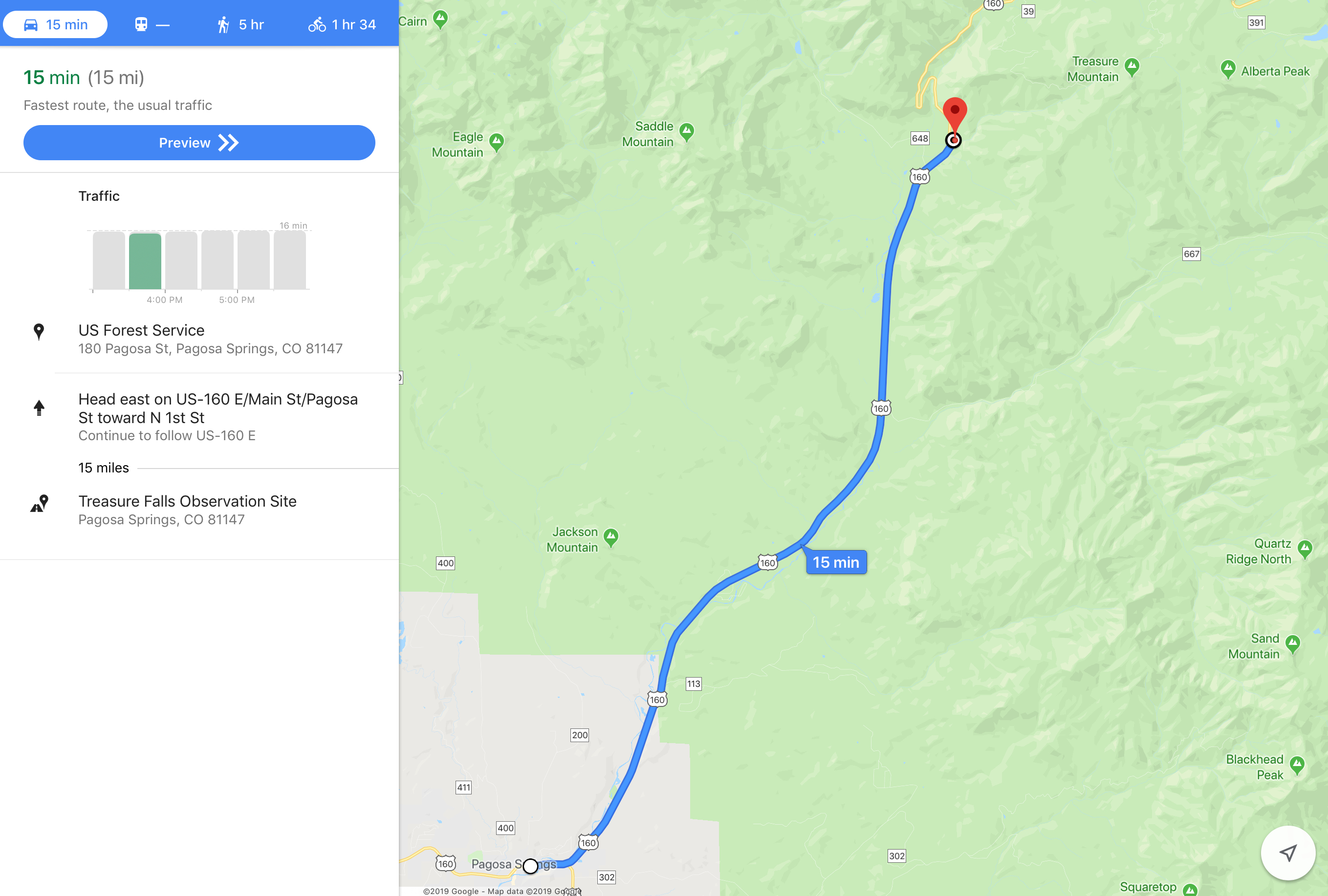
Driving directions: Travel east from Pagosa Springs on US Highway 160 about 16 miles to the Treasure Falls parking area on the right (east).
Driving directions map: <click here>
After hiking up to Alberta Point earlier that day, we thought a short easy hike would be great to end our day, so we decided to take the Primitive Trail. Easy? Boy were we wrong! Most of the trail looked like washout and was very steep going up and we feared for our well being on the way down to the base of the falls! We loved it! We did, however, take the regular trail back to the car.