


Please share any trail updates in the Comment section below
Trail update :
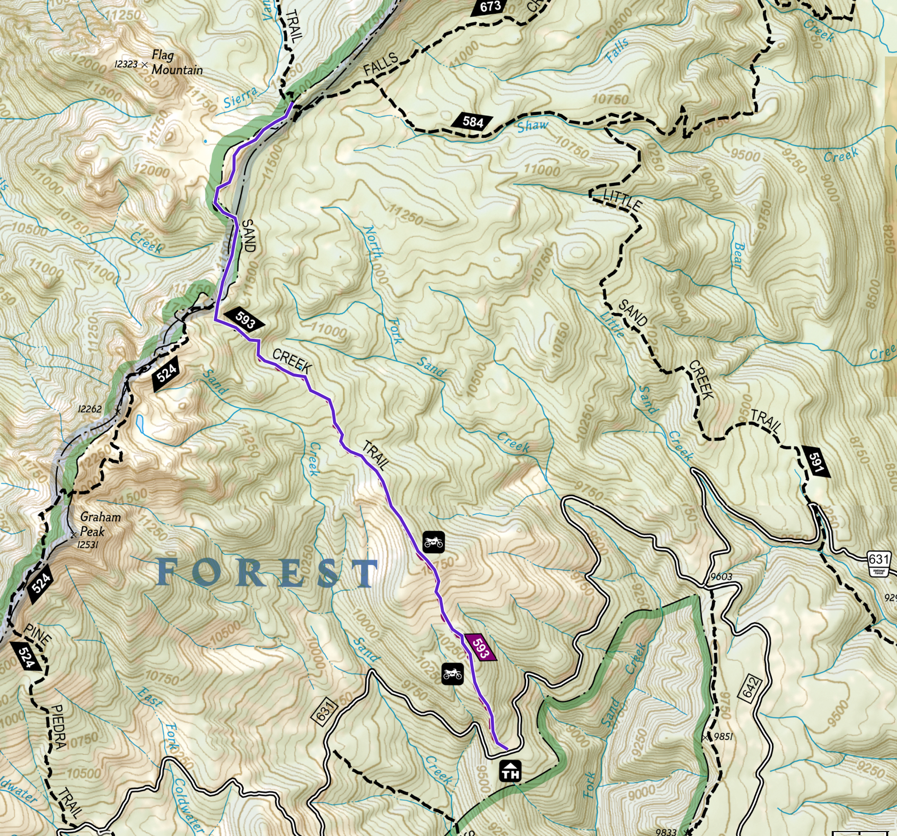
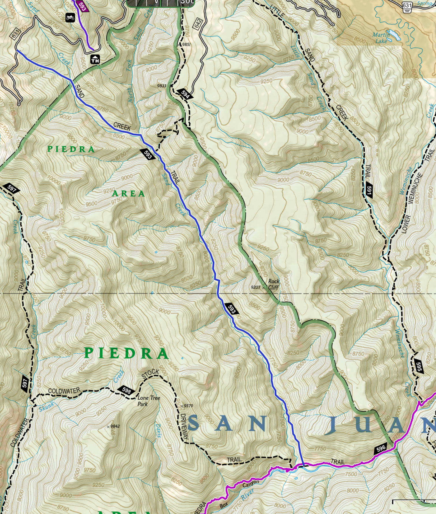
Sand Creek Trail #593 Maps: upper section: Click here Lower section:Click here
Length: upper section: 5.5 miles one-way. Lower section: 8.4 miles one-way
Elevation Stats: Upper section: Elevation gain 1,850 feet (altitude 9,650 to 11,500 ft with 2,552 ascent and 675 feet descent). Lower section: Elevation loss 2,200 ft (altitude 9,700 ft to 7,500 ft with 806 ft ascent and 3,143 ft descent).
Trailhead Facilities: none
Trail summary: Sand Creek Trail stretches from the Piedra River to the Weminuche Wilderness but is divided into upper and lower sections by FS road # 631. The upper section leads steadily upward to the Weminuche where the trail splits into either Falls Creek Trail #673 or Sierra Vandera Trail #541. The far easier downhill lower section can be reached at a trailhead on the left approximately 2 miles farther on FS road #631. The trail descends along Sand Creek and ends at the Piedra River Trail; the latter can be followed to the Piedra River Trail trailhead on Piedra Road # 631.
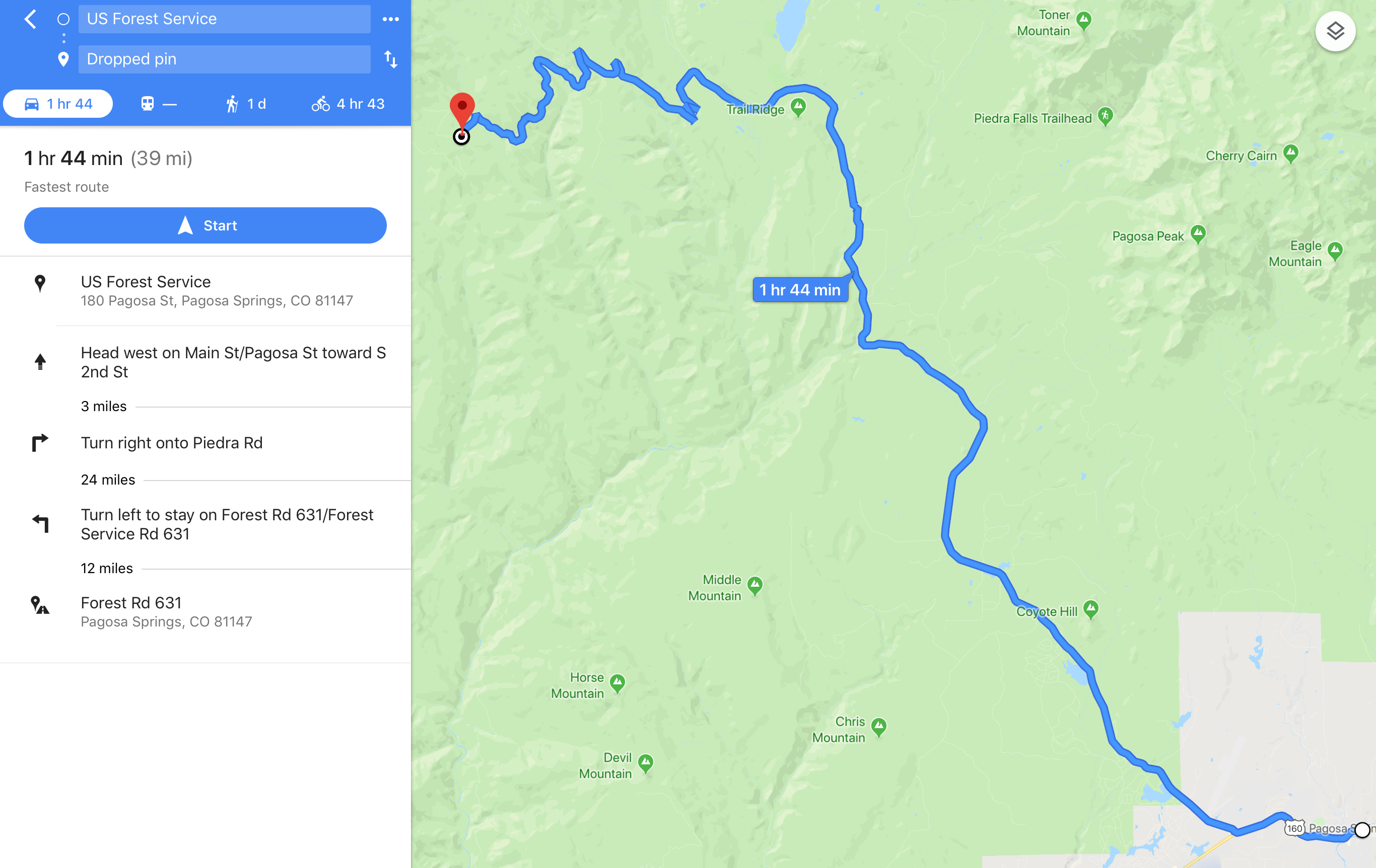
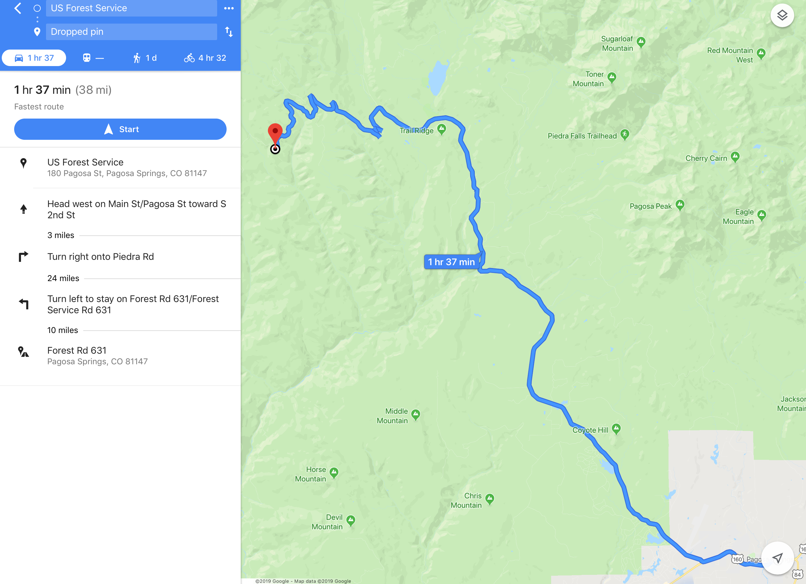
Driving directions maps: upper section: Click here Lower section: Click here
The Sand Creek Trail from the Mosca Road to the Pine-Piedra Trail has been cleared.
looking at the latest Forest Service map on the Sand Creek fire – it looks like this trail and 594 would be in the closure area?