Trail Update: 6.6 miles of trail has been cleared of down trees by pagosa Ranger District trail crew. 103 trees cleared.
Please share your comments in the Comment section below.
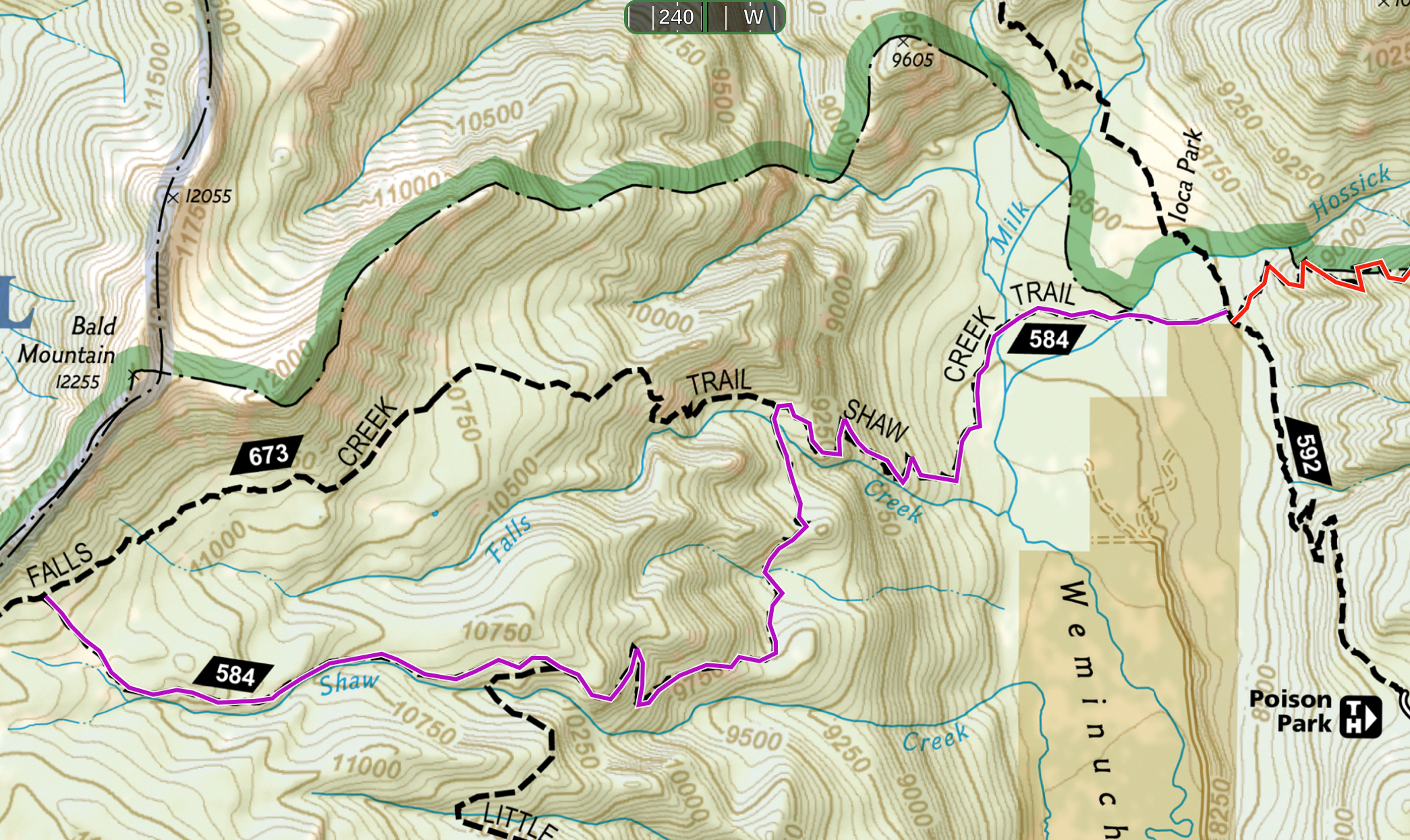
Shaw Creek Trail #584 Map: Click here
Length: 6.6 miles one-way
Elevation Stats: starting elevation 8500’. Total ascent 3,462 ft, total descent 619 ft. ( one-way).
Trail Comments: Shaw Creek Trail is a connecting trail between Weminuche Trail #592 and Falls Creek Trail #673 and is not recommended as day hike. To reach the trail, start at the Poison Park Trailhead and follow the Weminuche Trail approximately 2.3 miles north, where Shaw Creek Trail branches to the left (west).
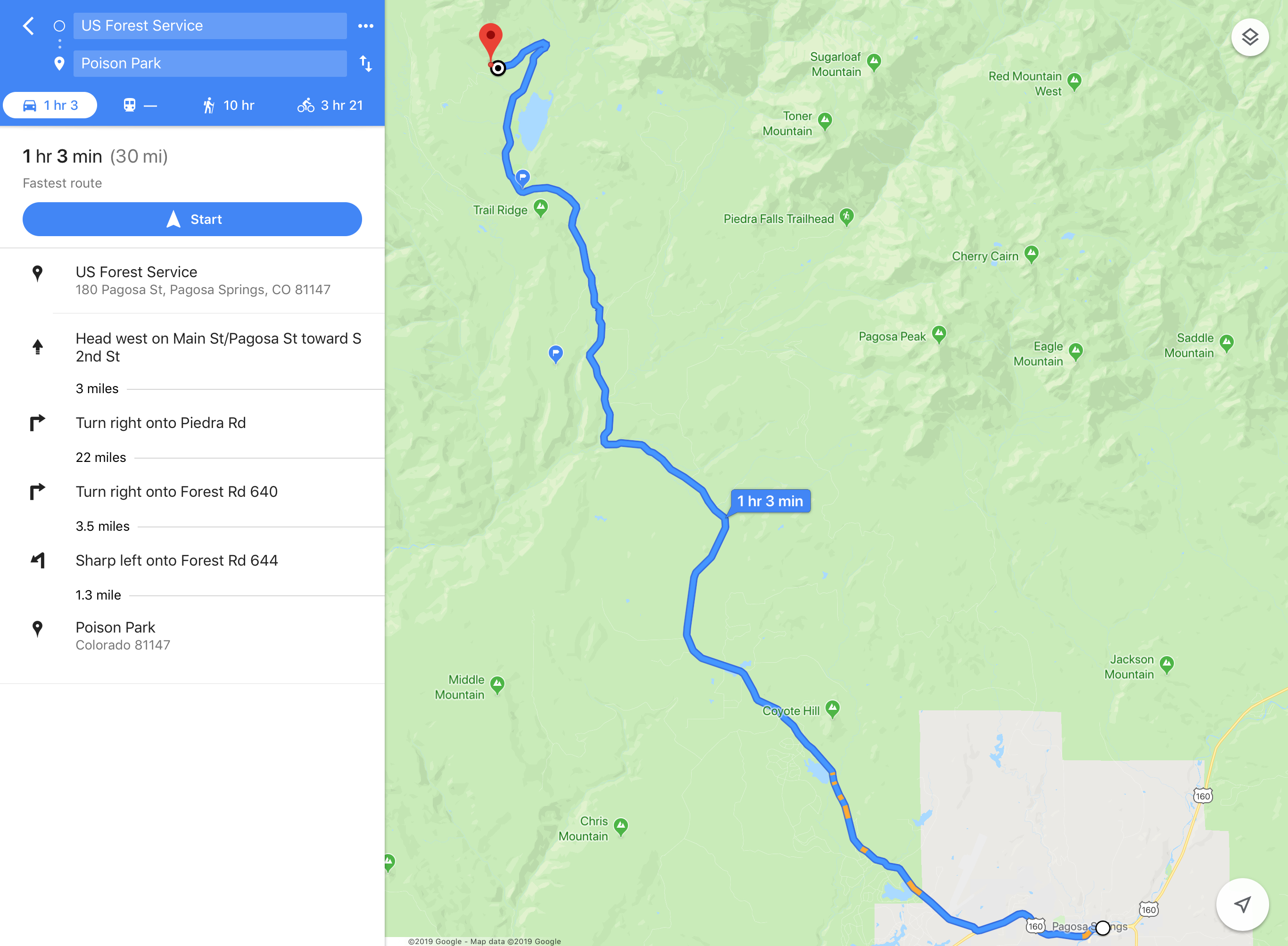
Driving directions: To reach the Poison Park Trailhead, drive north on Piedra Road (CR 600/ FS 631 to the intersection with FS 640 (Williams Creek Road). Turn north and drive an additional 3.5 miles to FS 644 (Poison Park Road), turning west and then another 3.0 miles to the trailhead at the end of the road. Driving directions map: Click here
About 20 trees down in the section between little sand trail junction and falls creek trail junction. The Shaw Creek trail disappears into the wet meadow about a half mile before the junction with falls creek trail.
As of 6/21/20 the Shaw Creek Trail from the Little Sand Creek Trail west (up hill) to the intersection with the Falls Creek Trail is clear of trees.
Thanks for the info on Shaw Creek and Little Sand.